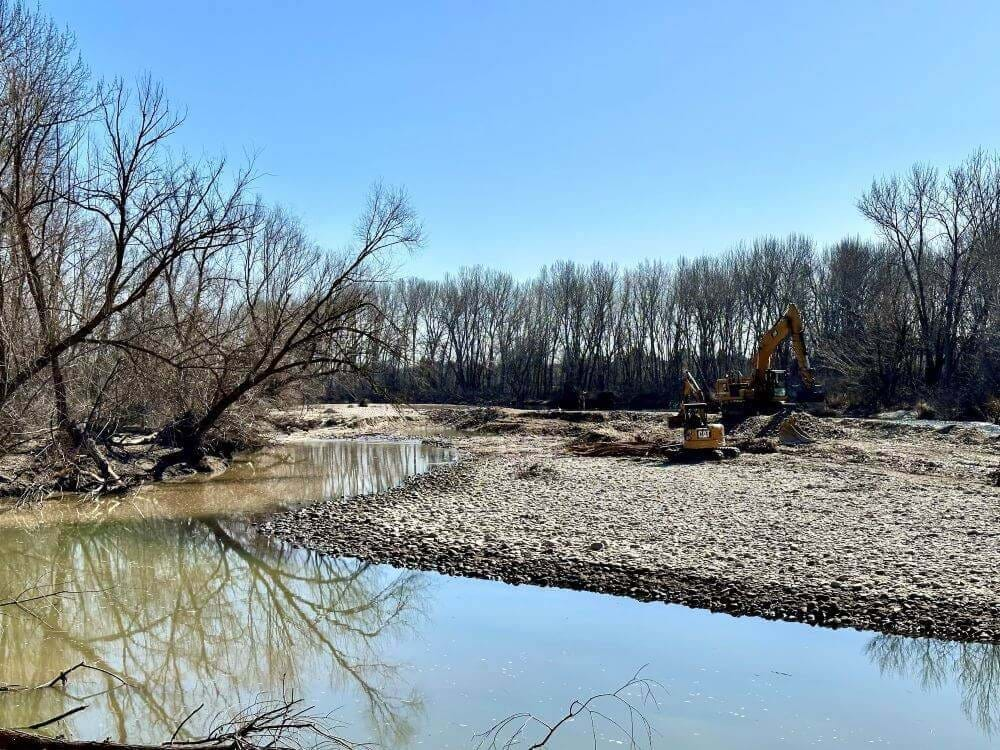
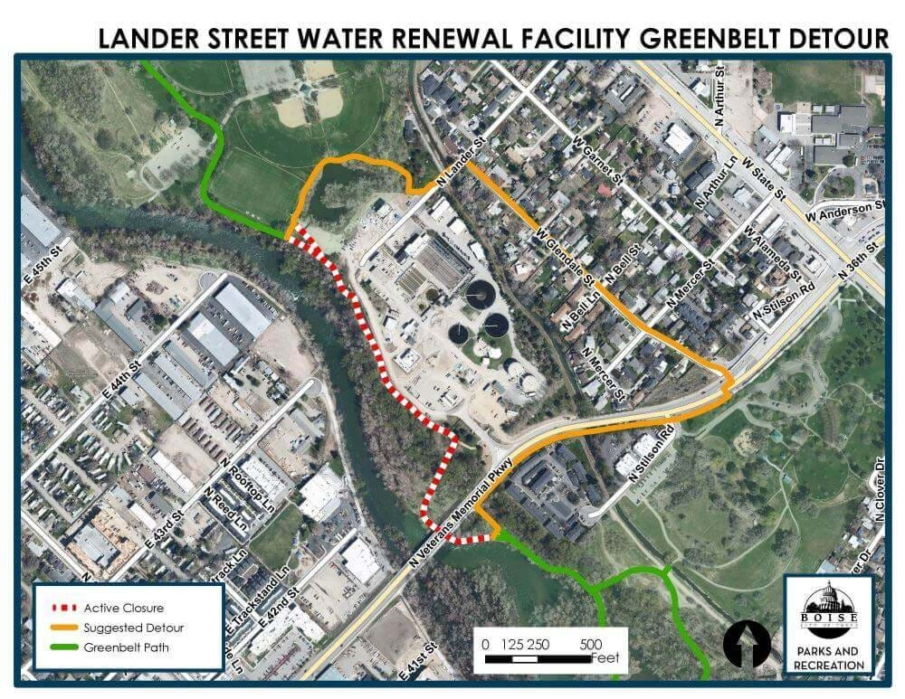
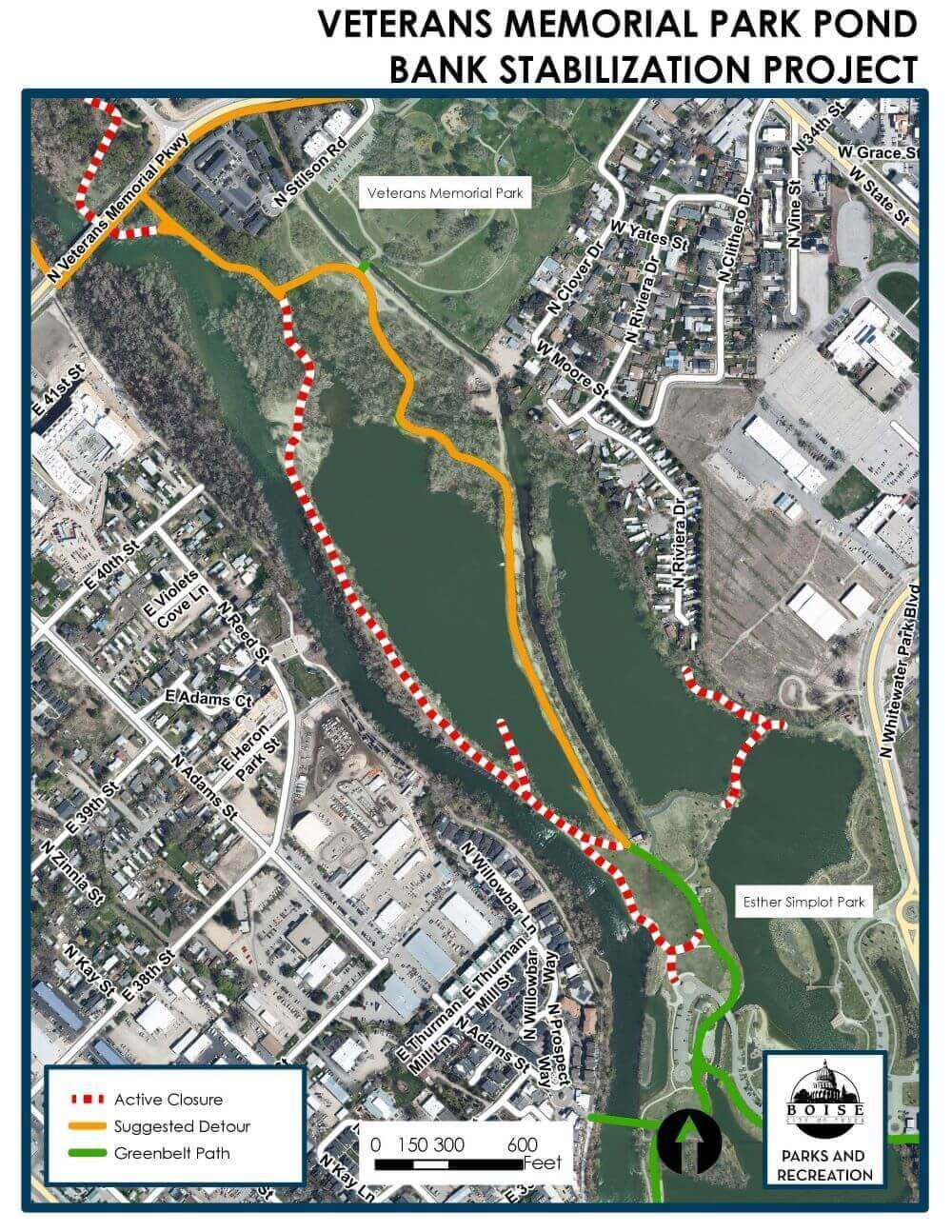
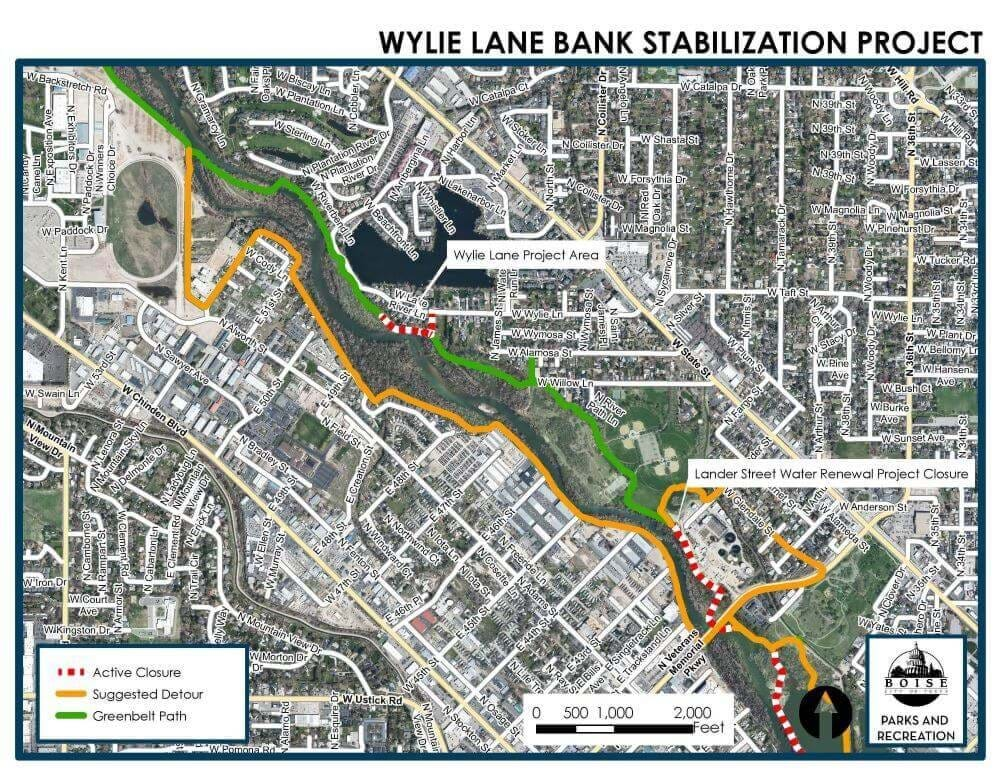
Several construction projects are temporarily impacting travel on the Boise River Greenbelt. In addition to closures already in place next to the Lander Street Water Renewal Facility at Veterans Memorial Parkway and an interior pathway closure for bank stabilization work in nearby Veterans Memorial Park, an additional project and closure starts today, Monday, February 26, adjacent to Wylie Lane near the Willow Lane Athletic Complex. The emergency bank repair work happening in the river and along the Greenbelt path at Wylie Lane is necessary to address erosion following flooding in recent years. It’s happening in anticipation of future habitat improvement at the site.
Residents and visitors can learn more about all three of these projects on the City of Boise’s website and view the corresponding pathway closures and detours on the city’s online, interactive Boise Greenbelt map.
“Our team works hard to minimize closures along the Greenbelt whenever possible, as we know it is an important transportation and recreation route,” said Boise Parks and Recreation Director Doug Holloway. “However, these projects are necessary to improve the riverbank and stability of this important transportation corridor long-term, and we appreciate the public’s patience and cooperation as the work wraps up before the busy summer season.”
Detours are signed and posted at pathway junctions along the Boise River Greenbelt in areas impacted by these projects (see attached maps for more information). Thank you for staying out of closed areas for your own safety.
All three of the projects are expected to be completed in April. The bank stabilization projects are taking place now ahead of the irrigation season and anticipated increases in Boise River levels this spring.
The City of Boise’s Parks and Recreation Department maintains approximately 25 miles of the Boise River Greenbelt within Boise City limits on the north and south sides of the Boise River. The seamless connectivity of the Greenbelt that runs from Lucky Peak all the way to the City of Eagle is a multi-jurisdiction managed pathway that totals approximately 50 miles.