Floodplain Management Plan

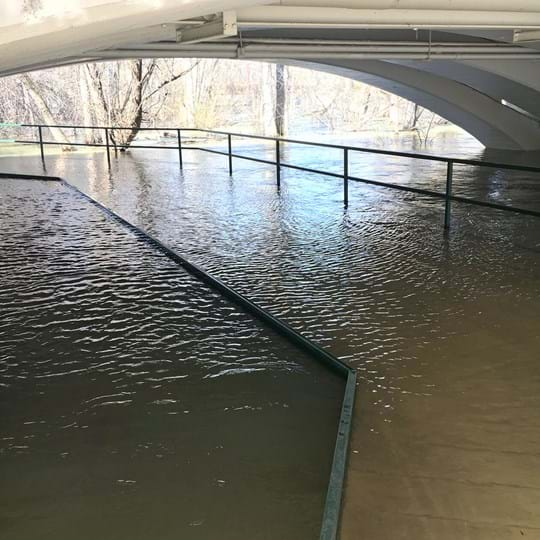
On December 2, 2011, the City of Boise adopted the Ada County Emergency Management Agency’s All Hazards Mitigation Plan. That plan was updated in 2015 and again in 2017. The City was a partner in preparation of the plan. In the Hazard Mitigation Action Plan Matrix contained in Table 2-10, Volume 2 of the Plan (Boise Annex), the City of Boise identified 16 different Initiatives it would pursue related to mitigation of Seismic, Flood and Wildfire hazards in the City. Five of those initiatives concerned flood hazard mitigation efforts.

As required by the City’s participation in the National Flood Insurance Program’s Community Rating System annual recertification process, Boise is reporting on our progress with each of the flood-related initiatives identified in the plan under Activity 510. This report will also address any flood events which occurred in the past year, any changes in our capabilities that could impact implementation, and consider recommendations for changes/enhancement.

Action Plan Initiative Progress

Initiative #B-1 | Esther Simplot Flood Channel

A flood study of the Boise River between Main St. and Veteran’s Memorial Park bridges is underway and expected to result in a project to modify overbank areas in the park to reduce flood potential in both Garden City and Boise City.

Progress

Boise City has continued to work with adjacent irrigation companies, the park developers and their consultants in a plan to modify the river bank and adjacent City owned park properties on the north side of the river to increase the conveyance capacity of the river and overbank area to reduce potential flooding of developed areas on both sides of the river. In 2014, a Conditional Letter of Map Revision (CLOMR) was prepared and submitted to FEMA that documents a “no-impact” condition for Esther Simplot Park construction and reconstruction of the river inlet structure for Farmers Union Canal. It was approved by FEMA later that year. HDR has been hired to survey, model, and submit the LOMR based on current conditions at the park and wave shapers.

The final Letter of Map Revision (LOMR) will be submitted to FEMA for approval late this year (2020). With the LOMR approval the Flood Insurance Rate Maps (FIRM) will be modified in this area to include all improvements and increased conveyance channels.

Initiative #B-5 | Flood Containment Facility Maintenance

Continue to maintain foothills flood containment structures located within our gulches (Hulls, Stuart, Crane Creek, Cottonwood Creek etc.) and the flumes that run through parts of the City.

Progress

Boise City has continued its normal high-quality maintenance of all foothill’s containment facilities. This involves annual inspection, clean-out, weed control, bank and fencing maintenance and inlet/outlet repairs as needed.

Initiative #B-6 | Maintain Boise's Compliance

Maintain Boise’s compliance and good standing under the National Flood Insurance Program (NFIP).

Progress

Boise has continued to administer the floodplain development regulations with diligence and accuracy. Public Works Engineering staff coordinate with PDS Planning and Building staff to review all development applications in the floodplain for compliance with the standards. We require Elevation Certificates for all new construction and substantial improvements and maintain copies on file in the office. This year, we approved 23 final Elevation Certificates. We also work with applicants in the processing of Letters of Map Revision (LOMR’s) as necessary. This year, one LOMR was approved, for Harris Ranch Subdivision – Warm Springs Creek Realignment (LOMR19-10-0196p).

In 2020, after significant outreach, the City adopted a new flood insurance study that expanded the boundaries of the floodplain. A concurrent amendment, updating the regulations for development in the floodplain was approved. Both the new floodplain maps and regulations became effective June 19, 2020.

Initiative #B-7 | Maintain City's Classification

Continue to maintain/enhance the City’s classification under the Community Rating System (CRS).

Progress

Boise continues to participate in the CRS classification program with the goal of maintaining our Class 6 rating. Our annual public outreach letters include detailed information including a flood map, the history and the nature of flood events in Boise, how the floodplain is regulated, how to prepare for and maintain safety in flood events and a detailed list of contacts. Boise provides proof of all the monitoring, record keeping, reporting, system maintenance and training necessary for a Class 6 rating. The recent amendment to the development code will help maintain the rating.

Initiative #B-15 | Coordinate with Local Experts

Whenever possible, coordinate with local experts and employ natural environmental processes in mitigation activities that increase ecosystem resilience and reduce the impacts of flooding on the built environment.

Progress

Public Works Engineering staff is resolved in ensuring our riverbanks are not completely rocked and is using techniques to soften the bank repairs, when applicable, with vegetation and natural techniques. There have been several projects that river barbs, live stumps, Fabric Encapsulated Soil Lifts (FESL), and natural stone, have been used to mitigate riverbank projects.

Flood Events from 2017-2019

Boise City has no repetitive loss areas and has experienced only minor, isolated flooding since 2017. In the Spring of 2017, however, a heavy snowpack and unusually high dam release rates did cause significant damage to banks and greenbelt pathway facilities along the river. Boise obtained a FEMA grant and the appropriate floodplain permits for repair of those areas. Parks and Recreation submitted and was approved from several grants from FEMA. That work has since been substantially completed.

Changes in Capabilities that Could Affect Implementation

Boise has not experienced any negative changes in the capabilities of staff or staffing levels that would affect our ability to continue to implement the Action Plan for flood mitigation. In fact, we have increased our capabilities. Our Public Works Assistant City Engineer obtained his Certified Floodplain Manager certificate in 2017. Similarly, since assuming the duties of Floodplain Administrator, the Deputy Planning Director has taken several courses in floodplain management. This training is an enhancement of our staff capabilities for floodplain management plan administration.

Recommendations for Changes or Enhancements

This was the ninth year after adoption of the new Ada County All Hazards Mitigation Plan/Floodplain Management Plan in 2011. It was comprehensively updated in 2015 and was subject to minor update in 2017. Our efforts remain focused on Initiative #B-1, the Esther Simplot Park Flood Management project. This is a multi-year planning and construction project and we will continue to refine the plan through 2021 and will submit final elevation survey data to FEMA after completion of the as-built plans and modeling. No changes or additions to the Action Plan are recommended at this time.

With the recent adoption of the Floodplain Maps and Development Code, the Planning Team will be updating the associated application forms, templates, and checklists. The intent is to provide more clarity on the regulations, requirements, and risks associated with development in the floodplain.

Message Sent Successfully!

Message Failed To Send.

Send a Message to PDS

Thank you for contacting Planning & Development Services. Please fill out the form below and a representative will be in touch with you. If you are inquiring about a specific project, please include the record number or project address.