Specific Plan Districts provide a means to create new zoning regulations for unique areas and developments where other conventional zoning mechanisms cannot achieve the desired results. Specific plans shall implement and be consistent with the comprehensive plan including the Future Land Use Map and policies. The purpose of a Specific Plan is to create unique zoning regulations for the buildout of a community over time.
Specific Plan Districts provide a means to create new zoning regulations for unique areas and developments where other conventional zoning mechanisms cannot achieve the desired results. Specific plans shall implement and be consistent with the comprehensive plan including the Future Land Use Map and policies. The purpose of a Specific Plan is to create unique zoning regulations for the buildout of a community over time.
Each Specific Plan application shall include two of the following three elements, to be selected by the applicant:
- Natural Systems - a commitment to permanently protect and manage open space, natural systems and resources.
- Housing Affordability - a commitments to deed restrict at least 10 percent of residential to households earning not more than 60 percent of the Area Median Income (AMI) for the Boise area if the dwelling unit(s) is a rental unit; or 15 percent of residential units affordable to households earning no more than 120 percent of the Area Median Income if the dwelling unit(s) is for-sale property, for a period of at least 20 years.
- Sustainable Building Design - a commitment that the project will include conformance with sustainable building practices including Silver Certification by the U.S. Green Building Council (USGBC) Leadership in Energy and Environmental Design (LEED) rating system or the adopted City of Boise Green Building Code.
Other Applicable Code Considerations
- Examples of Specific Plans
- Specific Plan Elements
- Land Use Controls
- Initiation
- Minimum Area Standards
Adopted Specific Plans
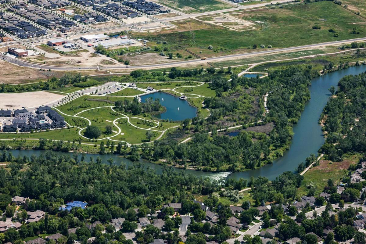
Harris Ranch
The Harris Ranch Specific Plan District was adopted December 11, 2007. Except where specifically provided in the zoning code, land buildings, structures and uses must follow the specific plan regulations.
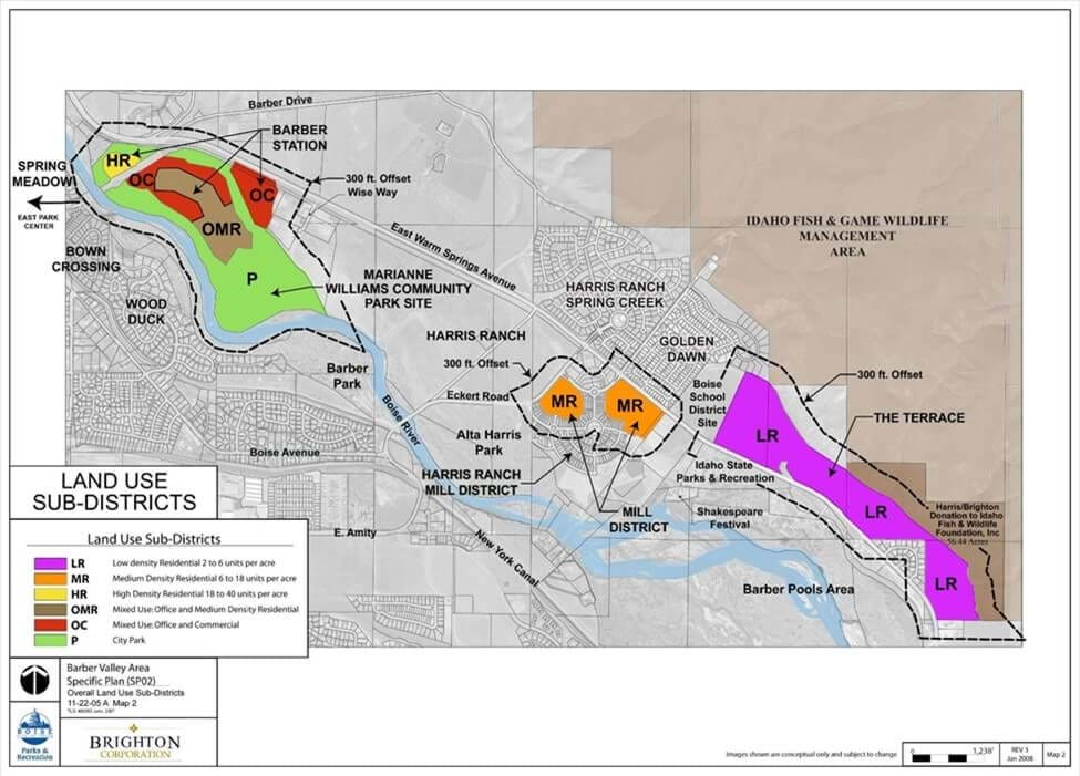
Barber Valley Specific Plan
This Barber Valley Specific Plan Zoning Ordinance applies to all property designated on the Barber Valley Specific Plan Zoning Map and the Barber Valley Specific Plan Land Use Sub-Districts Map in lieu of the standard Zoning Districts, except where noted in code. The sub-districts include the following:
- Low-density Residential (SP02-LR)
- Medium-density Residential (SP02-MR)
- High-density Residential (SP02-HR)
- Mixed Use: Office and Medium-density Residential (SP02-OMR)
- Mixed Use: Office and Commercial (SP02-OC)
- City Park (SP02-P)
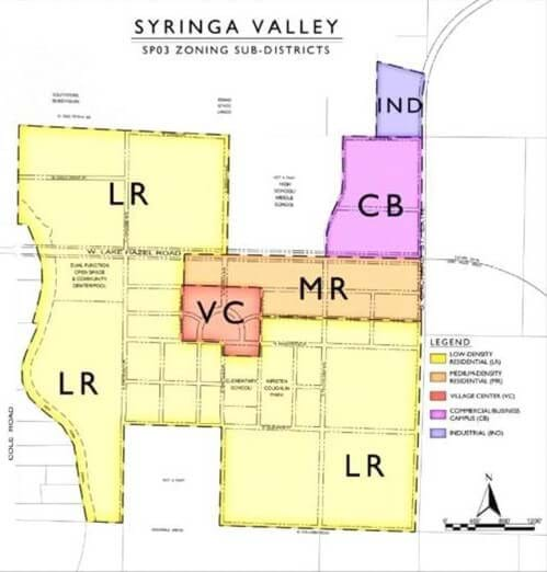
Syringa Valley Specific Plan
The Syringa Valley Specific Plan Zoning Ordinance applies to all property designated on the Syringa Valley Specific Plan Overall Sub-Zoning Map in lieu of the standard Zoning Districts, except where noted herein. The sub-districts include the following:
- Low-Density Residential (LR)
- Medium-Density Residential (MR)
- Village Center (VC)
- Commercial/Business Campus (CB)
- Industrial (IND)
Send a Message to Planning
Thank you for your interest in the Planning division. Please fill out the form below and a representative will be in touch with you. If you are inquiring about a specific project, please include the record number or project address.